
The Indian-European Alliance System: The Contest for the Indian Ocean, Part 1
The Indian Ocean has long been viewed as something of a strategic backwater. Despite its centrality to Eurasian trade routes for over two millennia, including Middle Eastern oil exports in modern times, it has seen surprisingly little in the way of large-scale naval warfare. There have been none of the extended rivalries that existed in the Mediterranean, where Romans and Carthaginians, Venetians and Genoese, Christians and Turks all vied for control of the waters over centuries. Even in the great wars of the 19th and 20th centuries, there was nothing to compare to the titanic clashes in the Atlantic or Pacific—the Napoleonic, Imperial German, and Japanese navies were little more than nuisances to British control.
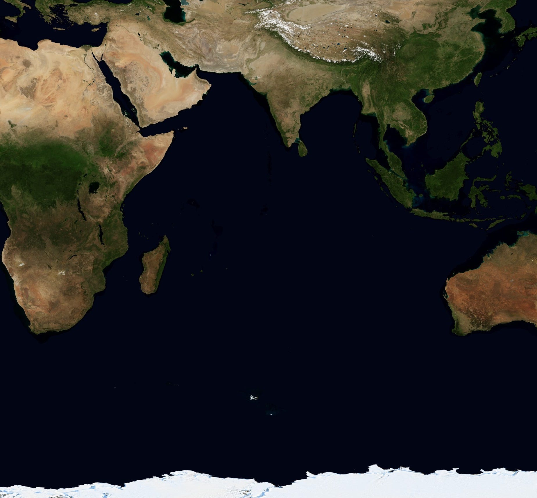
It is understandable why. The ocean is enormous: twice as wide as the Mediterranean and several times as large, with open water to the south. The western rim has historically been bordered by rugged deserts and the primitive states of sub-Saharan Africa, while the eastern rim was covered in impenetrable jungle, with only a few commercial ports that gave access to the interior.
The most densely-populated region part of the littoral, the Indian subcontinent itself, is a land mass surrounded by water—not, like the Mediterranean, a body of water surrounded by a long coastline. This meant that it was easier for the advanced, populous states of the region to attack one another or to trade overland, using naval power only as an auxiliary—a pattern that recurs throughout history, up through the India-Pakistan wars of the 20th century.
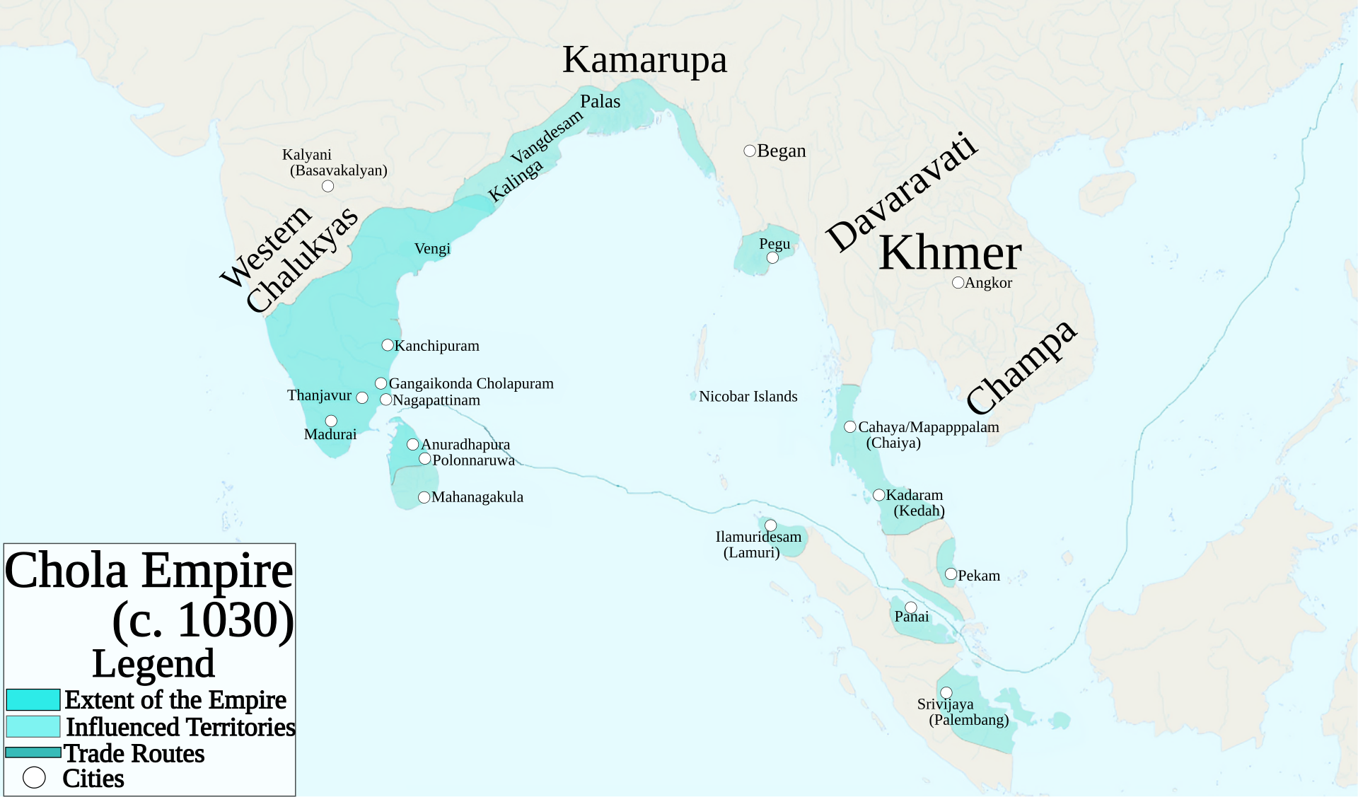
Even then, most maritime warfare was focused on control of commercial ports more than territorial conquest, with merchant ships playing a disproportionate role. This was as true in the era of European colonization as it was India’s more distant past: the Chola Empire of southeastern India relied on their merchant guilds for their conquest of parts of Sumatra and Malaya, a rare instance of territorial expansion over open water.
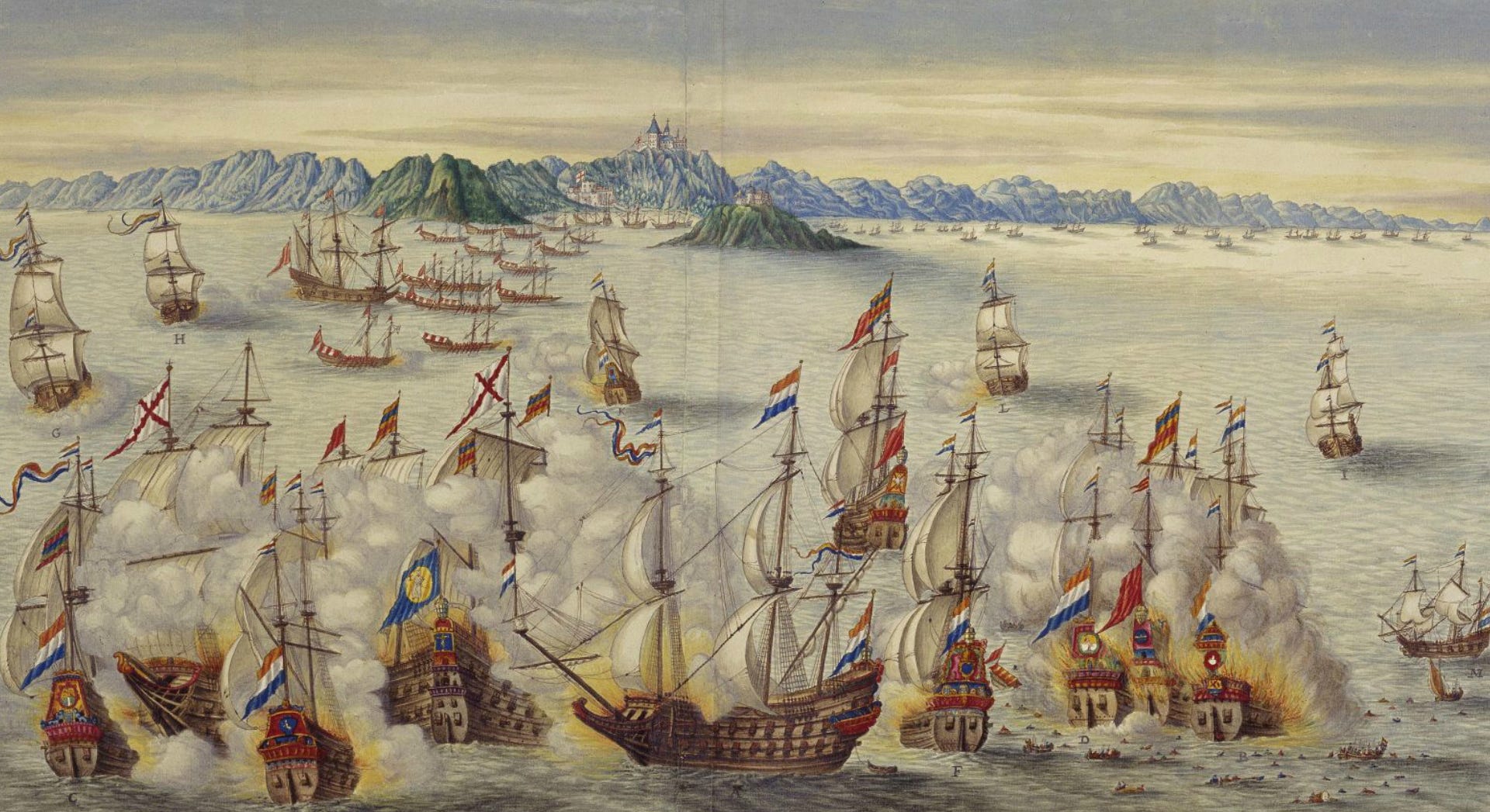
There have likewise been very few periods where two powers competed for mastery over the waters themselves. In those rare contests over sea lanes, the scope of the competition was usually limited—as when the Portuguese fought first the Mamluks and then the Ottomans for the waters between Egypt and western India. The most extensive by far was the protracted Dutch-Portuguese war which spanned the first six decade of the 17th century, in which the two countries attacked each other’s trading ports around the ocean’s rim. Yet for the most part, the fighting remained isolated from affairs on land, and neither side had the manpower to truly dominate the ocean.
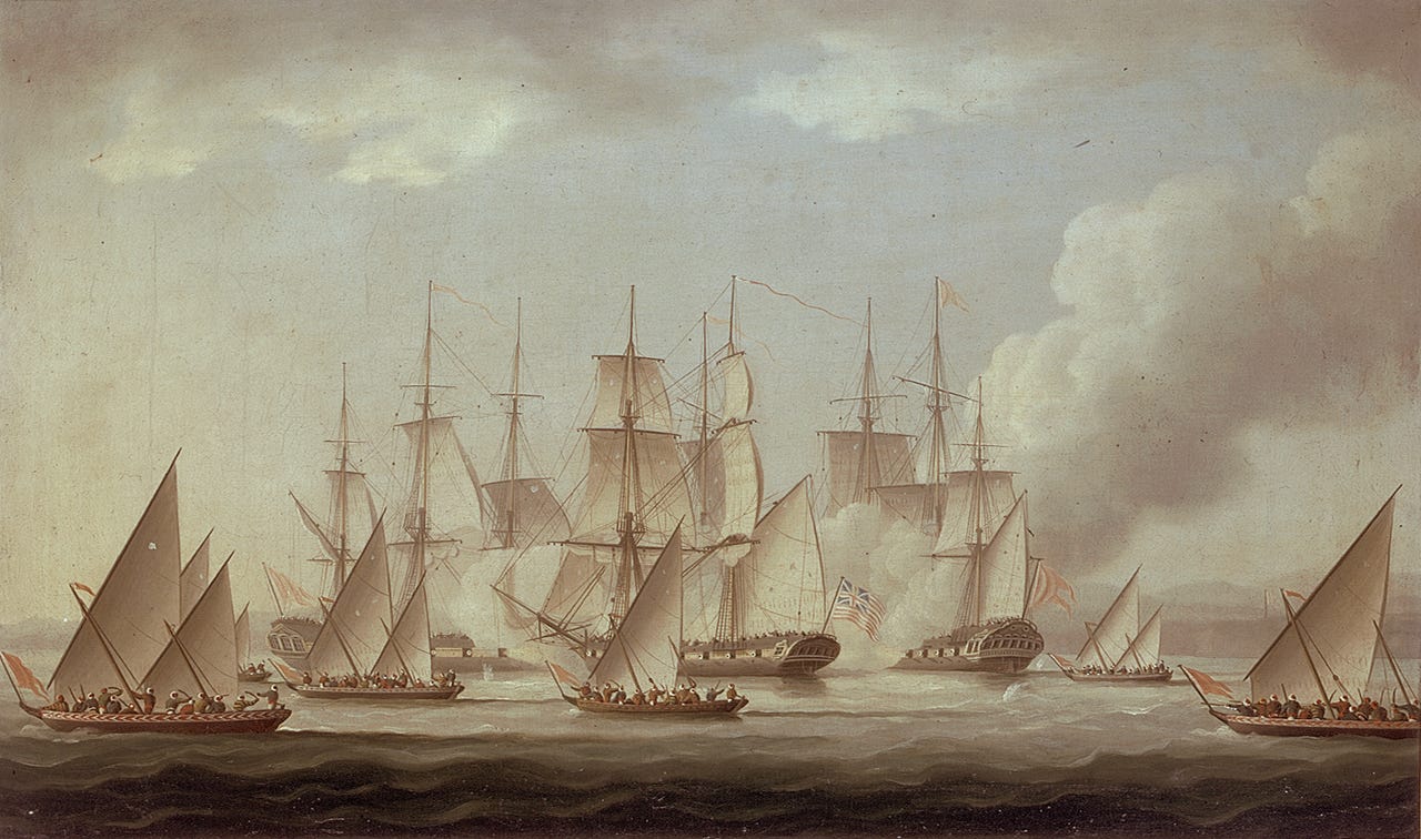
Only for a brief period in the mid-18th century did naval campaigns on the Indian Ocean become seriously intertwined with major wars on the subcontinent. Between 1746 and 1783, the Carnatic region on India’s southeastern coast became the flashpoint for several much wider conflicts. Britain and France held several trading stations there in close proximity, and fighting on land drew in states from all over India, whose troops made up the vast majority of combatants. The war at sea expanded beyond the usual wartime commerce raiding to include a number of fleet actions and amphibious operations.
In short, these wars were more than competition between colonial powers. They are better seen as clashes between entire alliance systems, turning India and its surrounding ocean into a single integrated theater. The scope and scale of these wars was immense, and their outcomes were determined by a complex interaction land power, sea power, and diplomacy. This piece will cover the first five years of this period, encompassing the First Carnatic War and the beginning of the Second.
The Arrangement of Power
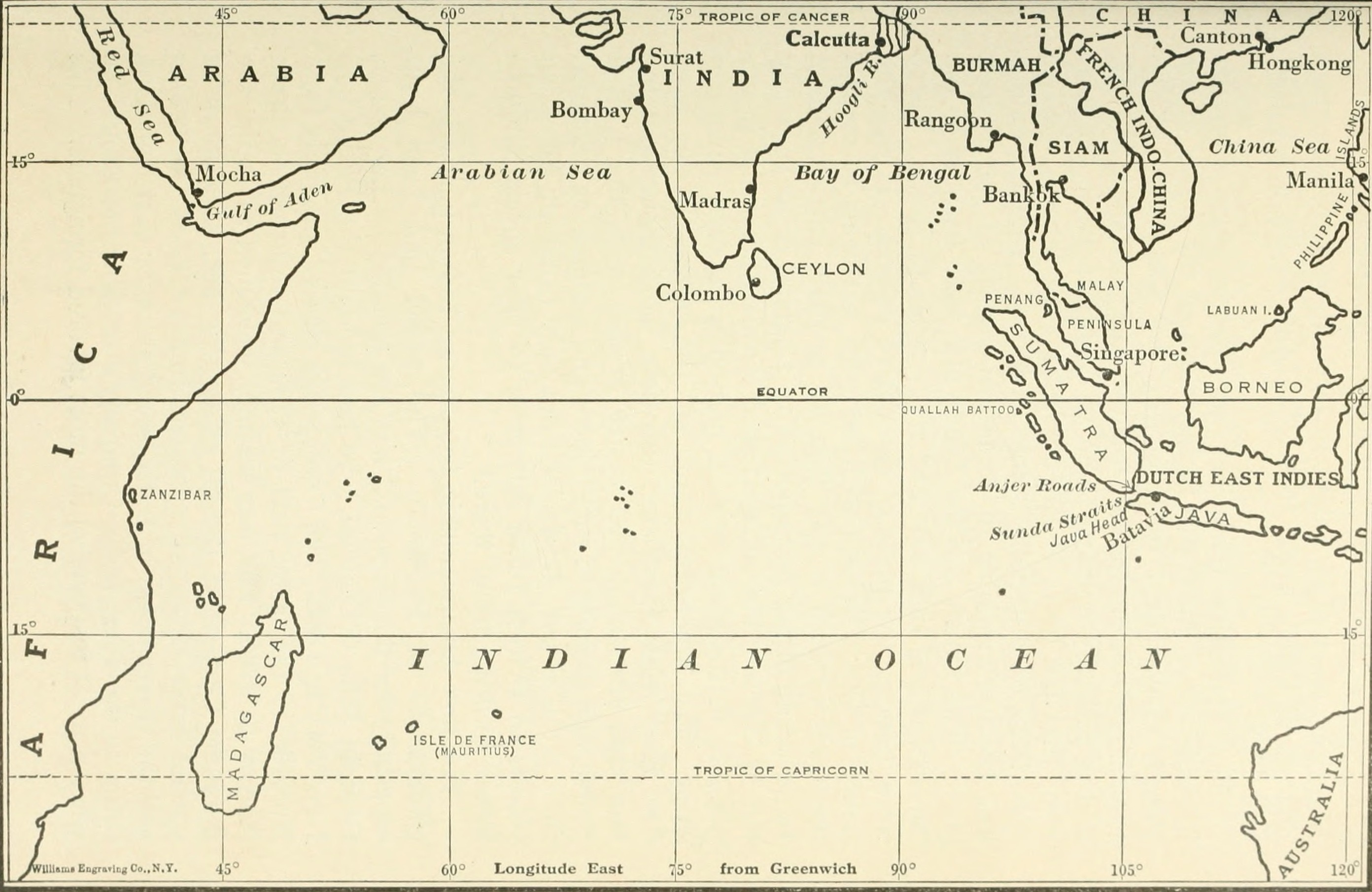
Britain and France were both relative latecomers to the eastern trade. The Portuguese had maintained a presence in India since their first arrival in 1498, gaining more than a century’s head start over their European rivals. The Dutch came next: although they chartered their East India Company two years after the English, in 1602, within three years they had established their first factories (trading stations) in India, and within a decade were building forts. By 1640, they established a foothold on Ceylon (modern Sri Lanka).
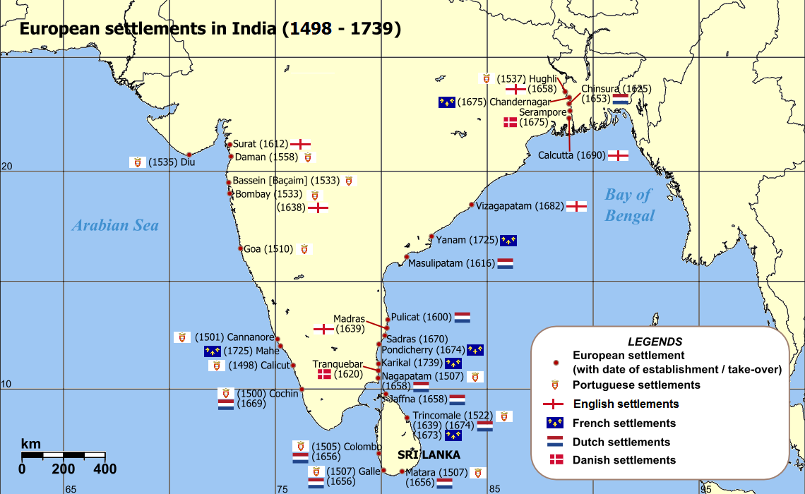
The English, by contrast, did not acquire their first factories until the 1610s and began building their first fort in 1640. The French arrived even later: they acquired their first factories in the 1660s and only gained permanent possessions beginning in 1673. Yet by the 1730s, the two were the ascendant European powers in the region. The British held Bombay on the west coast, the riverport of Calcutta in Bengal, and Madras (Chennai) in the Carnatic, as well as several smaller places. The main French possessions were Pondicherry in the Carnatic, the small port of Mahé in the southwest, and Chandernagore upstream from Calcutta.
This was a rare period of détente between their countries: following the near-constant warfare of Louis XIV’s reign, the two cooperated to maintain a peaceful balance of power in Europe. Relations began to sour after 1730 as the European alliance system repolarized, but as late as 1733, British and French merchants teamed up to forcefully expel a Swedish expedition trying to set up trade in southeastern India.
Ironically, this period of good feelings helped plant the seeds for the next war. Growing revenues from India, Canada, and especially the Caribbean convinced the French crown to invest more heavily in the colonies and rebuild its fleet. The two sides began calculating their available courses of action in the event of war.
The Royal Navy was the strongest in the world by this time, but did not have unlimited freedom of action. Its main naval adversary in the 1730s was Spain, with which it maintained a fierce rivalry in the Caribbean that led to all-out war in 1739. The island nation moreover relied on its navy for self-defense, preventing it from sending large squadrons to distant Asian waters. The French Marine Royale was a distant second, but made selective use of its warships and leaned heavily on the merchant marine to provide warships, giving it rough parity in the Indian Ocean.
The Indian Political Map
All the sea power in the world was useless without safe harbors to resupply and refit; all the sea power in the world was pointless without willing trade partners. European activity in the Indian Ocean therefore hinged on good relations with local princes who could provide both. Nearly all of India was under the nominal rule of the Mughal emperors in Delhi, who by 1700 had extended their authority almost to the tip of the peninsula. In reality, rule was delegated to a number of regional governors, who in the 1720s gained either formal or de facto independence. Five of these were particularly important.
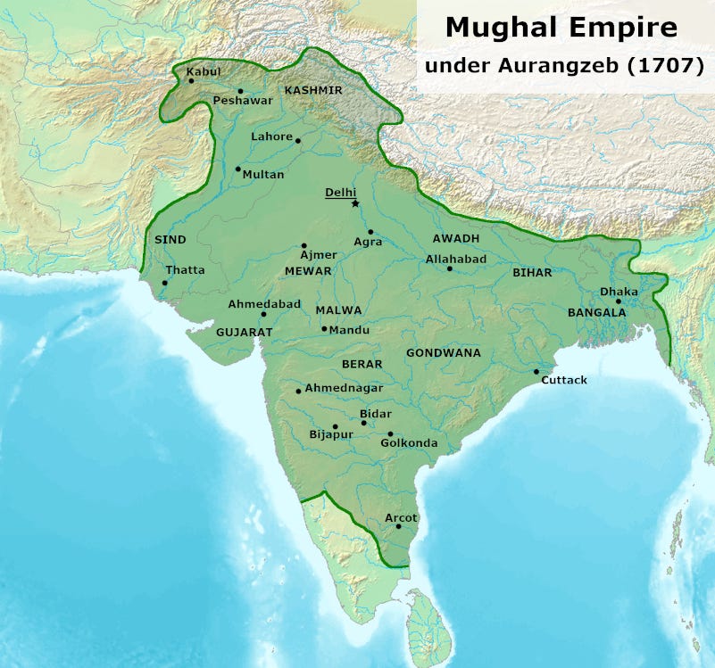
The first was the Maratha state, a Hindu state which had recently fought a long series of wars to maintain its independence from Muslim Mughal rule. The Marathas controlled the west central coast, from around Portuguese Goa in the south up to Gujarat, although in the coming decades they would expand inland and northward at their neighbors’ expense. In northeastern India was Bengal, ruled by semi-autonomous nawabs who maintained close relations to the court in Delhi and continued to pay substantial tribute.
East of the Maratha state in India’s central highlands—the Deccan Plateau—was Hyderabad, ruled by a former provincial governor who adopted the ruling title Nizam. The Nizams of Hyderabad held a status similar to the nawabs of Bengal, but also held intermediate authority over the nawabs of the Carnatic state on the southeastern coastal plain. Finally, south of Hyderabad, occupying the south-central highlands and southwestern coast, was Mysore, another Hindu state that had recently become a tributary to Delhi.
Neither France nor Britain maintained more than a few thousand troops on the subcontinent at any point during this period, and with the exception of Bombay, their stations and forts were not owned outright, but leased or held by treaty. The Portuguese had been able to strong-arm a few ports in the early days of their colonial ventures, but the rise of the Mughals made this impossible by the time other Europeans arrived on the scene—an attempt by the English in the 1680s to seize towns by main force badly backfired, and they were forced to give up all their holdings except for Bombay and Madras.
And despite the superiority of European ships, they could not simply throw their weight around at sea either. Several attempts by the British, Dutch, and Portuguese to capture ports on India’s west coast were frustrated by the Marathas, who maintained a coastal-defense navy to enforce tolls on European merchantmen; this, in combination with several well-armed forts, was sufficient to defeat various European efforts.
Strategic Geography
As Britain and France headed toward war in the 1730s, this delicate interdependence of land, sea, and diplomacy occupied the minds of strategists. The ports that enabled sea power could only be secured with troops and local princes; alliances could only be forced with the credibility that troops and cash provided; garrisons were dependent on local help and resupply from Europe.
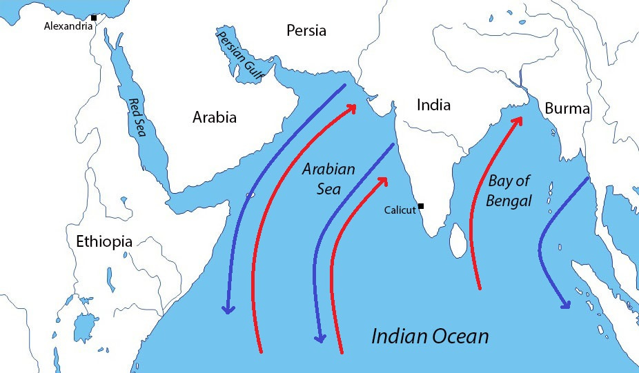
These calculations were further complicated by the bi-seasonal monsoon. A steady southwesterly wind provided fair sailing for ships rounding the Cape of Good Hope in spring; but by November, the monsoon reversed direction as rough winds blew out of the northeast. Ships that did not return to Europe at that time had to find shelter. There were few good harbors on India’s east coast that could protect ships during the winter monsoon, so the British usually retreated to Bombay.
The French had no such safe harbor: Mahé, their sole west-coast port, was small and indefensible. The Dutch possessed good harbors on Ceylon (modern Sri Lanka), and both the Dutch and Portuguese held ports on India’s west coast, but these were not certain to be available in wartime—both powers had frequently been at war with France in recent decades. Accordingly, the French acquired Mauritius and Réunion off the East African coast (named Île de France and Île Bourbon, respectively). These bases gave their ships refuge in winter months and a secure supply base along the trade routes—located in open water more than 4,000 km from either the Cape Colony or Bombay, any amphibious attack against them would be extremely difficult.
Like French stations in India, these islands were under the control of the French East India Company, officially named the Compagnie des Indes. The notorious financier John Law had brought all royally-chartered trading companies—those of the East Indies, the Mississippi, China, etc.—under the aegis of a single Company of the Indies. After its spectacular bankruptcy in 1720, the crown rescued the Company and thenceforth exercised much greater control, subsuming its interests to national strategy.
Keep reading with a 7-day free trial
Subscribe to The Bazaar of War to keep reading this post and get 7 days of free access to the full post archives.