In August 1863, the focus of both sides in the American Civil War shifted to a small corner of southeastern Tennessee. The region had already seen some fighting that summer during the Tullahoma Campaign, where in the span of two weeks, William Rosecrans’ Army of the Cumberland drove Braxton Bragg’s Army of Tennessee out of Middle Tennessee at virtually no cost. This campaign, which concluded on 4 July, rounded out the Union victories at Gettysburg and Vicksburg. Although less decisive than those other two—Bragg escaped with his army intact—it put Rosecrans in a position to move on his major strategic objective: Chattanooga.
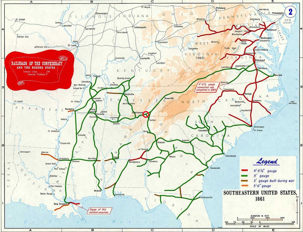
This small city on the Tennessee River was the most important rail hub in the Confederacy. From it, one could travel northeast to Virginia, west to the Mississippi, and southeast to the Deep South. Capturing it would disrupt the South’s internal traffic and open the road to Atlanta, offering the chance to split the Confederacy in two.
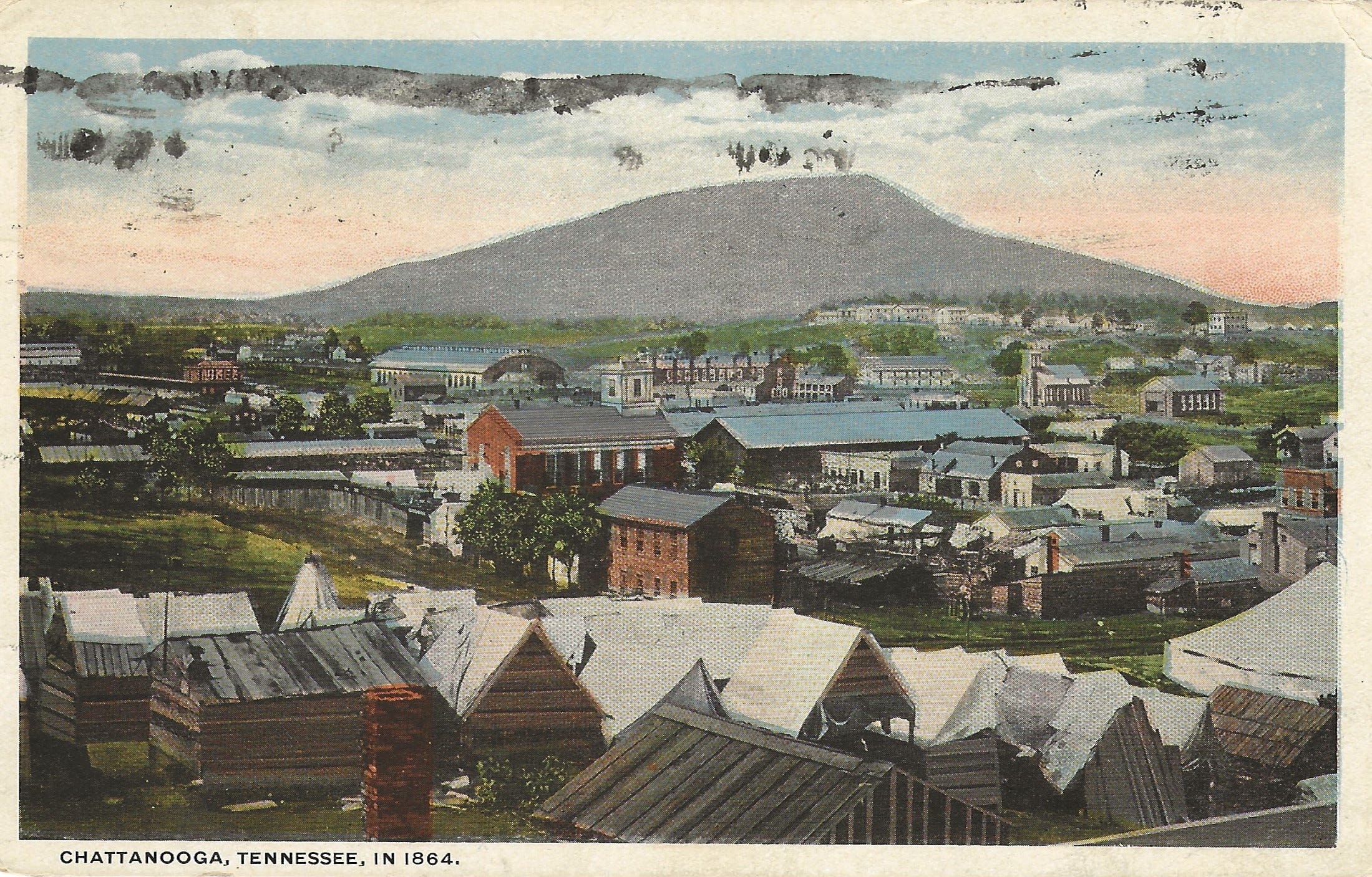
The campaign for Chattanooga got underway in late August. After several weeks of maneuvering, the two armies met on 19 September at Chickamauga Creek in a colossal battle that gave its name to the entire campaign. That two-day engagement—the second-bloodiest of the Civil War—stands with Antietam, Shiloh, and Gettysburg as a byword for the brutality of the war. Following a shocking Union defeat, Rosecrans retreated into Chattanooga, where the Army of the Cumberland was besieged for the next two months.
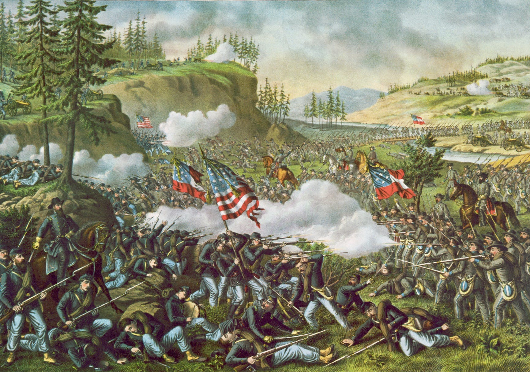
The Battle of Chickamauga was certainly consequential, and is a fascinating affair worthy of study in its own right. But from another perspective, the preceding campaign was far more important. Union forces succeeded in their primary objective of surmounting a difficult obstacle and securing themselves at Chattanooga; once reinforcements arrived, it was only a matter of time before they broke out. And from the perspective of this series—the effect of constricted geography on operational art—it is those preceding weeks of maneuver that hold our interest.
A Campaign in the Mountains
Following their victory at Tullahoma, Union forces faced a daunting task. Middle and East Tennessee are separated by a series of steep, parallel ridgelines, part of the greater Appalachian Mountains. The Tennessee River, which flows through these valleys, posed yet another barrier. Moving many tens of thousands of men and their supplies across these obstacles was a tremendous challenge in the best of circumstances. It was even more difficult against a thinking adversary who could use the tortuous geography to trap and destroy isolated elements.
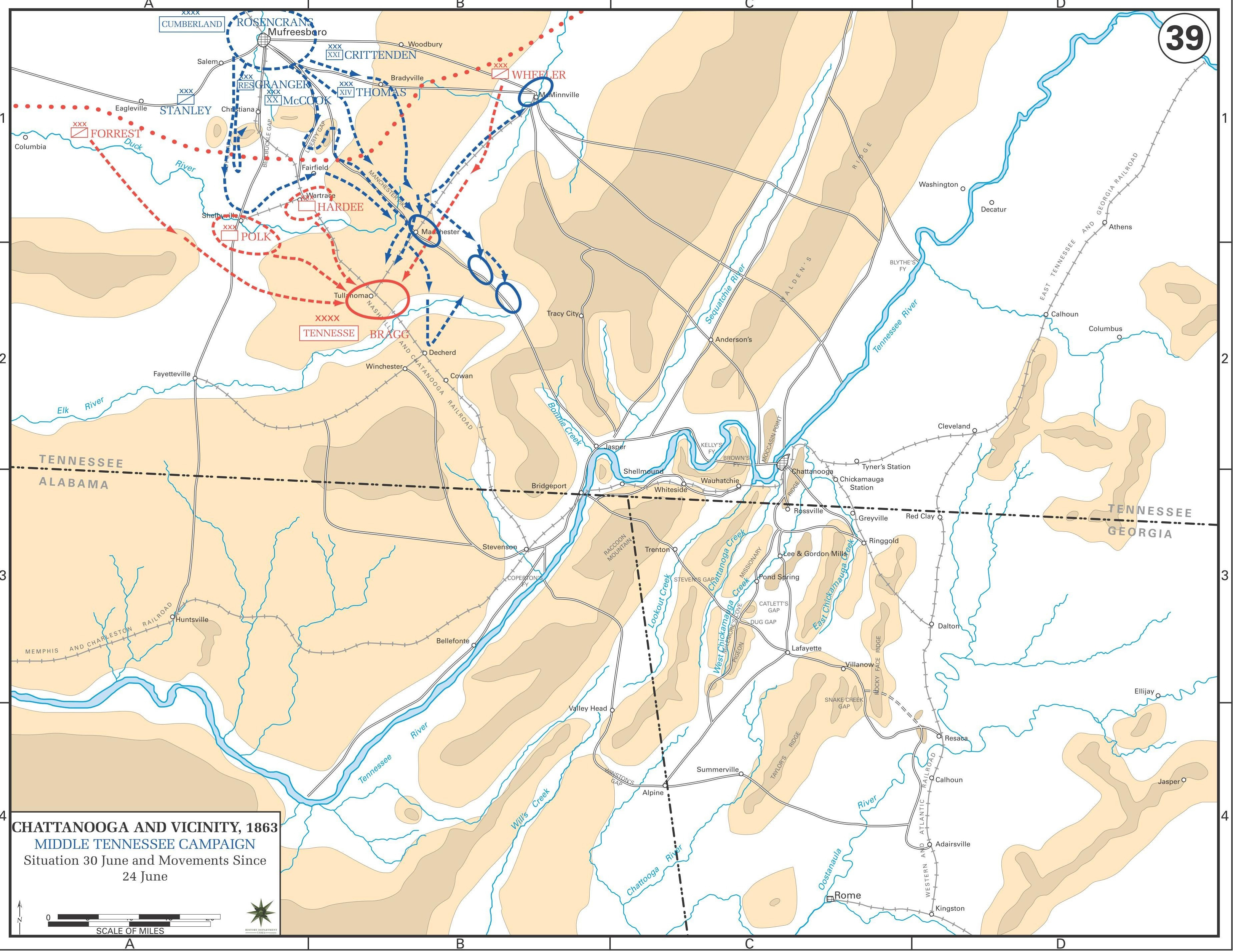
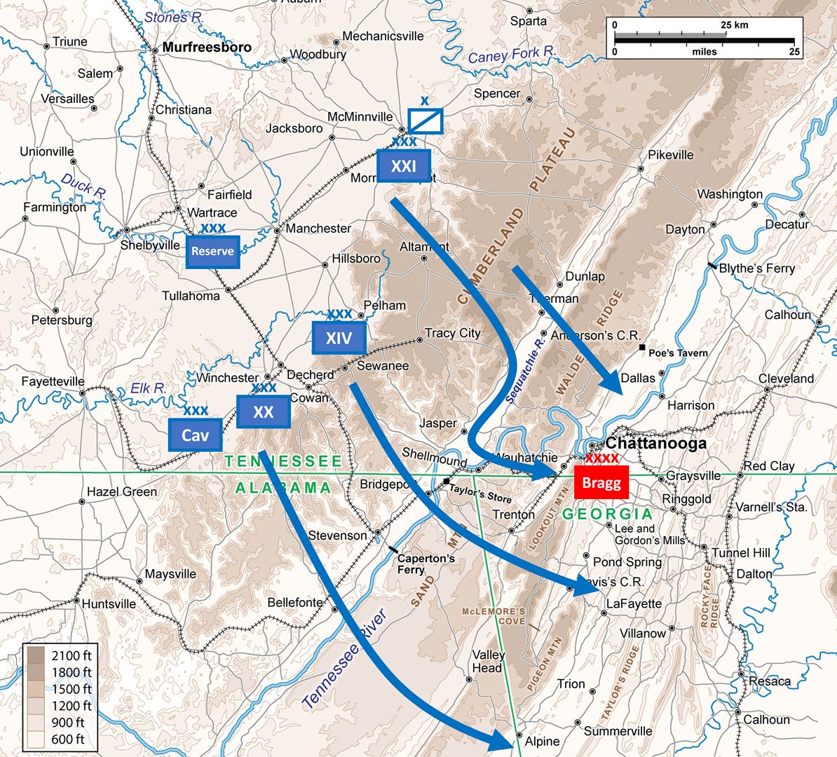
Yet by the same token, the geography invited complex maneuver on a grand scale. Making a virtue of logistical necessity, Rosecrans feinted against Bragg’s right to distract from several columns moving on a broad front against the enemy’s left—the mirror image of his maneuver at Tullahoma. Once secure on the opposite bank of the Tennessee, he attempted to fix the Confederate army in Chattanooga and cut it off from the rear. Bragg, who faced many of the same challenges of limited mobility and incomplete intelligence, tried to anticipate these moves while avoiding a fatal encirclement.
Chickamauga is a fascinating campaign because it showcases two imperfect generals dealing with an extremely complex operational situation. They both competed to read each other’s intentions amidst a poor intelligence picture, while their troops struggled to execute their orders, toiling over grueling terrain in summer heat, only to collide headfirst after five weeks. That this campaign of maneuver ended in such a bloodbath speaks to both generals’ virtues and weaknesses; to the particular limitations of 19th-century warfare and to the enduring effects of geography.
Part 1 looks at the first three weeks of the campaign, from when Union forces set in motion until they completed their crossing of the Tennessee River. From that point on, the two armies were separated by a single long ridgeline—Part 2 will look at the cat-and-mouse game that ensued, as both armies tried to catch each other at a disadvantage.
The Strategic Picture
By August 1863, most major theaters had fallen quiet. The loss of Vicksburg compelled the Confederates to abandon much of Mississippi. This left few remaining objectives in the vicinity that the Union considered of strategic importance, and the state lacked east-running rail lines to support a drive deeper into the Confederacy. In the east, Lee had pulled back to his home turf in Virginia, where he was well positioned to put up a tough defense—the two sides largely broke contact as they recuperated from the bloodletting at Gettysburg. It was thus that in July 1863, the attention of both North and South turned their attention to Tennessee: there lay their greatest hope and their greatest peril.
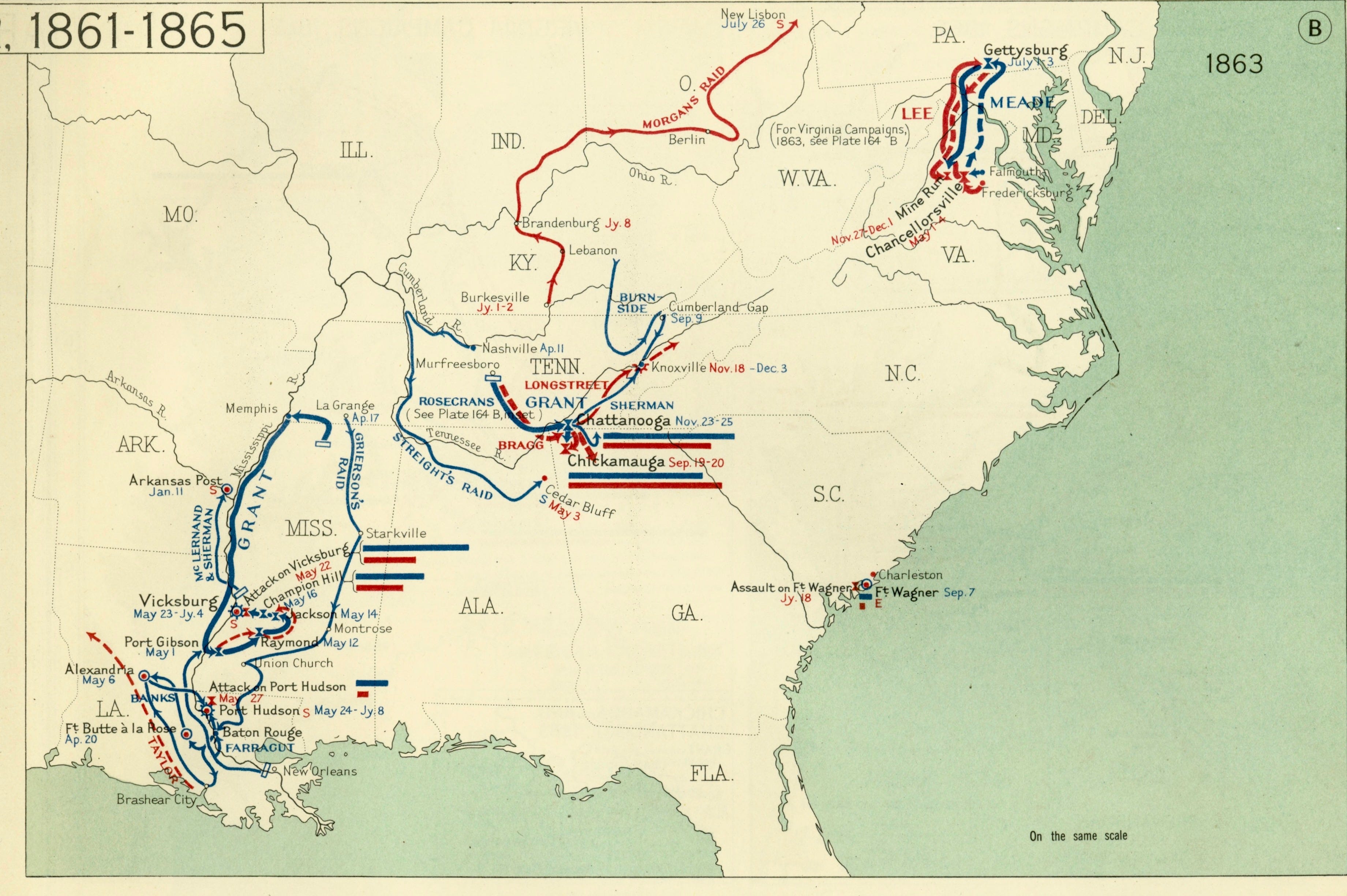
In purely numerical terms, the balance of forces heavily favored the Union. The strength of the two armies was largely unchanged from what it had been during the relatively bloodless Tullahoma Campaign: the Army of the Cumberland fielded roughly 65,000 men in all arms, while the Army of Tennessee had around 45,000, minus those who had deserted during the demoralizing retreat. Reinforcing Bragg was therefore a top priority for the Confederate government in Richmond, which could not afford to lose Chattanooga following the other disasters that summer.
Additional troops were close at hand. Simon Bolivar Buckner, commander of the nearby Department of East Tennessee, had 16,000 troops around Knoxville, just 160 km away. Other reinforcements were soon on their way: two divisions from Mississippi and troops from elsewhere in the South began arriving in late August.
Most dangerous of all from Rosecrans’ perspective was the possibility that Robert E. Lee would send reinforcements. He had the means to do so: a good railroad connected his camp in northern Virginia almost directly to Chattanooga. He could also afford to do so, having fallen back behind the protection of the Rappahannock River following his retreat from Gettysburg. His tough veterans were considered the best troops in the Confederacy, enjoying high morale and skilled officers—they threatened to give Bragg not just an outright advantage in numbers, but a meaningful qualitative edge.
This posed a great danger to Northern plans. Bragg had the advantage of defending the far side of very difficult terrain; Rosecrans could only hope to cross it unscathed if he created a diversion, which practically required an advantage in numbers. Nor could he compensate with reinforcements of their own: if Rosecrans’ greatest challenge was logistical, then adding numbers would only magnify his own difficulties.
Instead, the Union high command settled on a more sophisticated plan of support, involving strategic maneuver. This is something quite rare, much harder to coordinate than operational maneuver. Unlike the offensives earlier that spring and summer, which sought to overwhelm the enemy through simultaneous pressure on three fronts (Chancellorsville, Vicksburg, and Tullahoma), strategic maneuver entails action in one theater intended to create immediate and specific effects in another.
In the event, the supporting theater was not far from Chattanooga: it was centered on Knoxville, 160 km to the northeast up the Tennessee valley. Knoxville was important because it lay astride the rail line connecting Virginia to Chattanooga. If all went as planned, this would prevent Lee from providing timely aid to the Army of Tennessee, compelling any reinforcements to take a much more circuitous route along the South’s rickety rail network. This might also have operational spillover effects, distracting Bragg while Rosecrans’ army was at its most vulnerable, spread out in the mountains near Chattanooga.
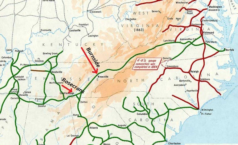
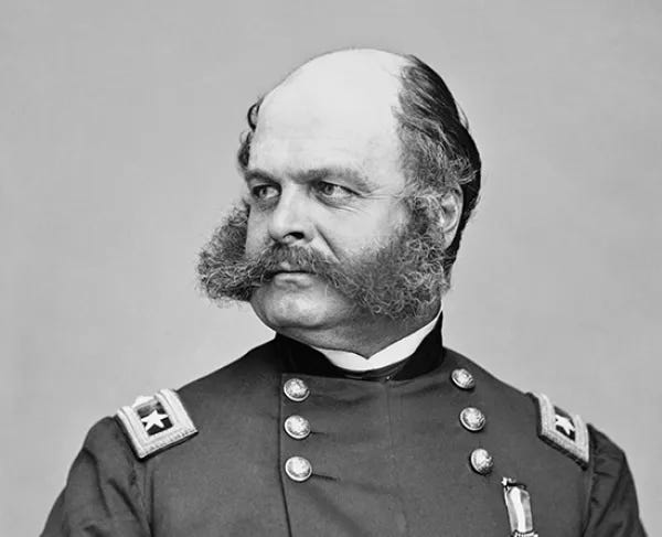
The task of this strategic maneuver fell to Ambrose Burnside, commander of the two-corps Army of the Ohio. Burnside had taken one of his corps to assist at Vicksburg earlier that year, but following the Union victory there returned to his headquarters in Kentucky. The same day that the Army of the Cumberland opened its campaign in mid-August, his own 18,000-strong field force would step off on a parallel march toward Knoxville.
The Geography of Chattanooga and Environs
Before zooming in to the operational level, it is worth looking at the complex geography of southeastern Tennessee. The country around Chattanooga is dominated by the many parallel ridgelines and valleys of the Appalachian Mountains, which run generally southwest to northeast—perpendicular to the straight route from Tullahoma to Chattanooga. Most of these had steep escarpments, accessible at only a few points, but relatively flat tops. The first of these from Rosecrans’ perspective was the Cumberland Plateau, roughly 30 km wide. Although the high ground is quite flat, it is also cut through with deep valleys, forcing the traveler to make a number of steep ascents and descents.
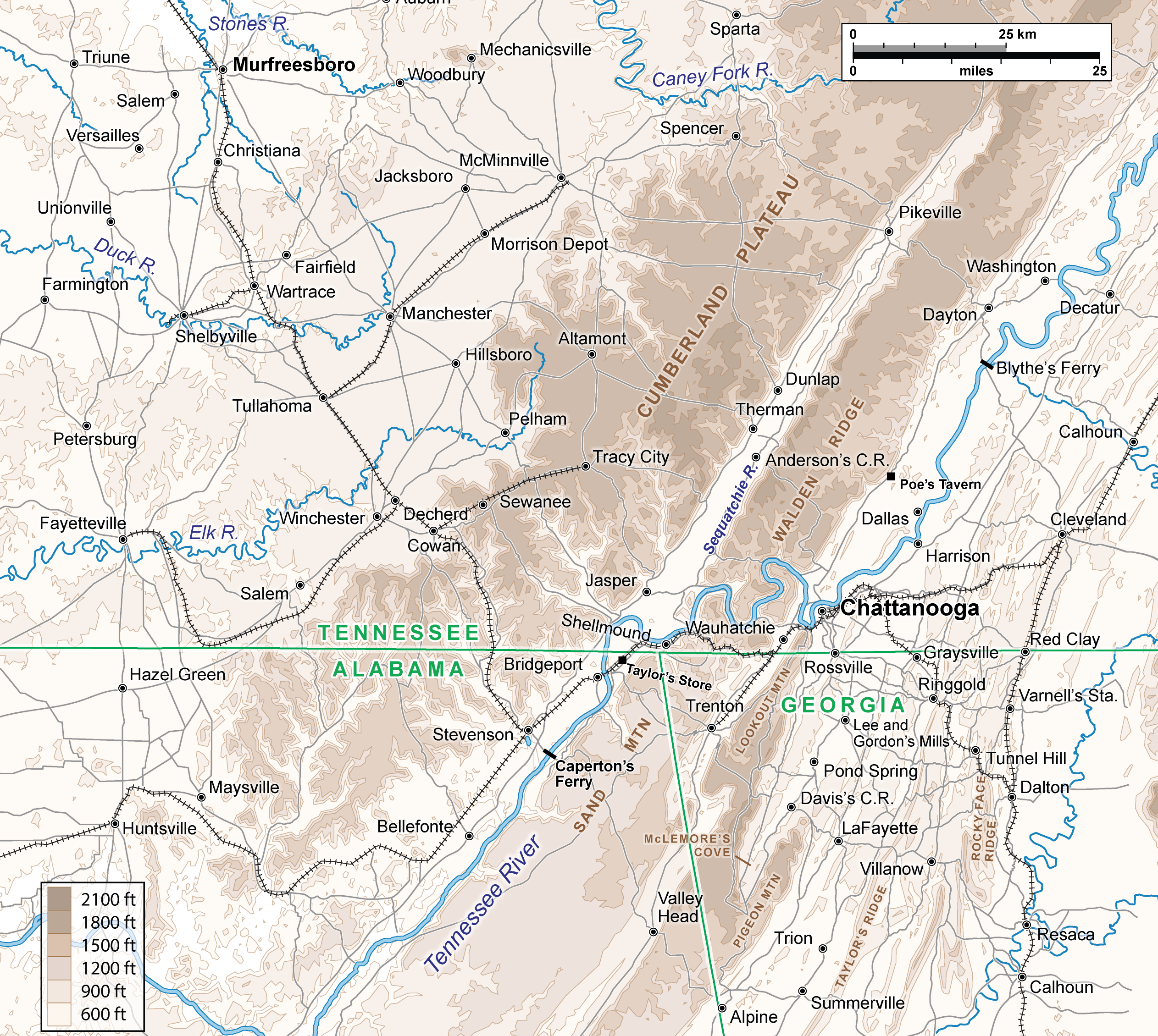
Beyond the Cumberland barrier is a broad valley, about 8 km across, followed by a 15-km-wide plateau. The Tennessee River cuts through the plateau before turning southwest into the valley, where it is joined by the Sequatchie Creek flowing from the northeast. The part of the plateau north of the Tennessee is called Walden Ridge, the part to the south Sand Mountain.
Continuing east from Sand Mountain is the narrow Will’s Valley, followed by Lookout Mountain, which ends abruptly at the river’s edge close by Chattanooga. This formation is considerably more complex. 50 km south of Chattanooga, Pigeon Mountain juts out like a thumb northeast from Lookout Mountain, forming a cul-de-sac called McLemore’s Cove.
These three sets of highlands—the Cumberland Plateau, Sand Mountain, Lookout Mountain—rise 200-400 m above the surrounding lowlands. Several much lower ridgelines run parallel to these terrain features, compartmentalizing the many valleys and making east-west travel and reconnaissance far more difficult. One such terrain feature bounded the operational environment to the east. 15-25 km from the Lookout/Pigeon Mountain complex is Taylor Ridge, a long, thin ridgeline that runs well past Chattanooga to the north and continues far to the south, forming the eastern edge of Broomtown Valley. Despite its relatively low elevation, its steep slopes made it a major obstacle: Ringgold Gap, through which the Atlanta railroad ran 25 km southeast of Chattanooga, was key terrain in the coming campaign.
It was through this variegated and difficult terrain that runs the other defining feature of the region: the Tennessee River. Originating just above Knoxville, it meanders west then southwest through a broad valley to Chattanooga, a straight-line distance of 160 km. There, it cuts a meandering course through Walden Ridge/Lookout Mountain before being joined by the Sequatchie and turning southwest. The river then dips into Alabama at the northeast corner of the state and flows back into Tennessee at the northwest corner, eventually joining the Mississippi.
The river was mostly navigable during the late summer months of the Chickamauga Campaign. Shallow-drafted boats could travel most sections between Knoxville and a point downriver of Huntsville, Alabama. This would be important after the campaign, when Union forces ran supplies by water to Chattanooga, but for the time being was of little help to them: unable to bring barges or gunboats upriver from the Mississippi, they had to move everything they needed by train or over difficult mountain roads.
Union Plans
The Army of the Cumberland spent a hot summer around Tullahoma preparing for the upcoming campaign. In order to cross the imposing obstacles before them, they had to stockpile enormous quantities of supplies to feed the entire army for several weeks. This was somewhat easier for having pushed the Confederates out of Middle Tennessee—they no longer had to worry about cavalry raids in their rear—but it was still a laborious task. They occupied an area on the Highland Rim called the Barrens, destitute of adequate forage, which meant that nearly all their supplies had to come via a single rail line from Murfreesboro and Nashville beyond.
The army itself looked much the same as it had during the previous campaign. Although there was some reshuffling in the divisions, the five corps retained their original shape and commanders: XIV Corps under George Thomas, XX Corps under Alexander McCook, XXI Corps under Thomas Crittenden, a two-division Cavalry Corps under David Stanley, and a Reserve Corps under Gordon Granger. Excluding the reserve, the main force probably numbered some 60,000 men.
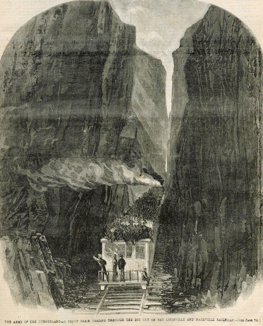
The only practicable way of supplying so large an army was by the single rail line running between Tullahoma and Chattanooga. This ran southeast through the Cumberland Plateau to the Tennessee River at Stevenson, Alabama, then turned 15 km northeast before crossing the river at Bridgeport. Union forces occupied both towns in late July, allowing the engineers to get to work repairing the lines and the quartermasters to begin stockpiling supplies. The Confederates had pulled up the planks of the rail bridge at Bridgeport but left the piers intact, meaning it could be restored to service without too much trouble. It was therefore almost by default that Rosecrans chose to approach Chattanooga from the south.
Bragg surely perceived this too, but Rosecrans nevertheless undertook to deceive him. The operation against Knoxville would anchor Bragg’s attention north, forcing him to consider the possibility that Burnside would continue down the Tennessee valley toward Chattanooga. This in turn raised the prospect of concerted action: even if the Army of the Cumberland established railhead at Stevenson, it might still advance from there up the Sequatchie Valley and cross the Tennessee north of Chattanooga. Rosecrans did everything he could to encourage these thoughts.
The deception took many forms. In the first place, he allowed a captured Confederate officer to overhear a staged discussion about stockpiling 100,000 rations at McMinnville, the road and rail junction 50 km northeast of Tullahoma. He then released the prisoner, expecting he would give a full report to Bragg. This ploy was given credibility by the presence of XXI Corps at McMinnville along with a cavalry brigade which regularly skirmished with Confederate pickets in the area.
As the army began its advance, it was to be preceded by a demonstration north of Chattanooga. Several brigades would drive back pickets along the riverbank upstream from the city, as if preparing for a crossing. These brigades were to be drawn from three separate corps, so that if the Confederates tried to deduce the Union order of battle, it would appear as if the bulk of the army was concentrating in the north.